
A brief introduction
What is it?
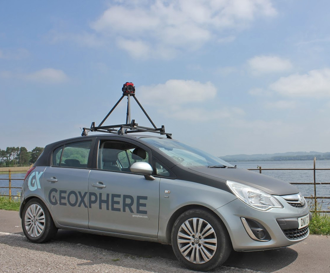
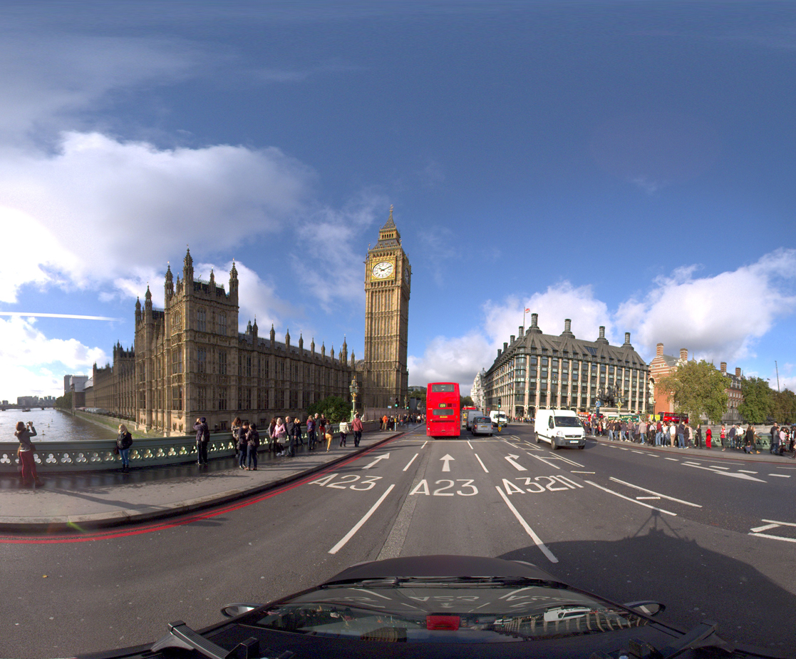
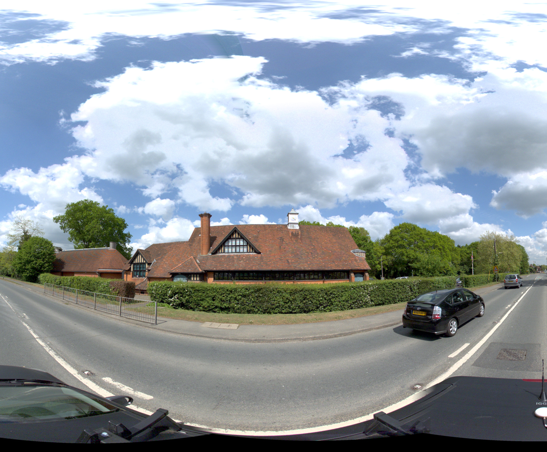
360 Survey is a service where we capture panoramic street-view style imagery of your chosen area. We can do it as a one-off or on a regular basis.
What does it do?
When we capture 360 panoramas for you, it gives you an up-to-date view of a particular location that you can then use in your day-to-day business.
How does it compare to other Mobile Mapping providers?
We aim to provide a simple and cost-effective service using our in-house built technology. We don't offer the 'frills' of other providers (such as LiDAR, which is often impractical to share with everyone) and we like to keep the costs down. There's also Google StreetView, which is free, but our customers prefer our service as it's reliable, time-stamped and to their specification.
What makes it unique?
There's nothing unique about our service, but we do provide an end-to-end solution where the data we captured can be streamed directly into XMAP Cloud GIS through the XMAP 360 module. This makes it convenient and easy to distribute throughout your organisation.
How much is it?
It depends on the distance that needs covering, and the number of images that need capturing and how often you'd like it done. Use a ballpark of £40 per line kilometre and a minimum price of £4,000. But it's best to speak to us to discuss your project.
Use Cases
Commissioning 360 imagery can be beneficial in a range of cases:
Using the time-stamped imagery in insurance and planning cases
By holding time-stamped, unedited data at regular intervals, fraud and claims against the organisation can be assessed accurately.
Derive asset information from the imagery
Extracting information such as street lights, building types, parking spaces and road lines can be carried out quickly.
We can help with a combination of manual and automated data extraction processes.
Providing regular assessments for site safety
Private installations such as business parks, universities, airports or power stations can use the imagery to review their health and safety compliance.
With multiple surveys, change can also be quantified.
Reduce reliance on site visits by staff to increase productivity
Up-to-date 360 imagery can often replace physical site visits, reducing car use and wastage of staff time.
Available Surveys
Our survey services include the planning, capture, processing and delivery of the data. We deliver the data on Hard Drive or via our XMAP 360 module.
Road Survey
Capturing public roads for a defined area, typically everything within a Local Government boundary, giving a comprehensive dataset.
Vehicle: Small Car
Pathway Survey
Capturing pedestrianised streets or cycle routes. Banksmen (or women) are used and permissions are sought before the survey.
Vehicle: Small Car, Quadbike or Tricycle
River and Canal Survey
Capturing rivers and canals to give an often-unseen view of the waterways. Great for assessing bankside develeopment and habitats.
Vehicle: Anything floaty
Offroad Survey
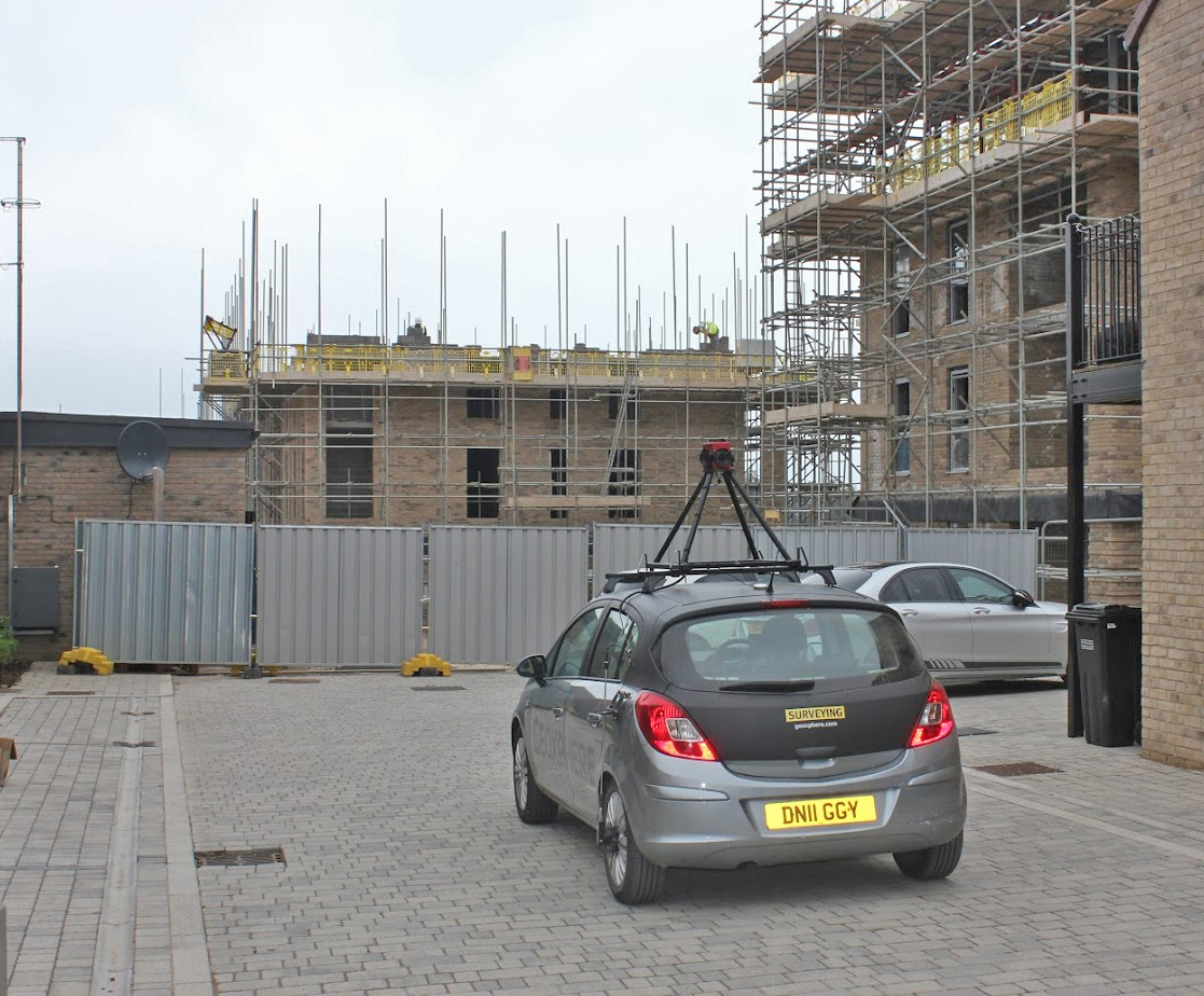
Capturing sites not accessible to normal traffic. Typcially green lanes, historic monuments, private estates, construction sites, airports and power stations.
Vehicle: Small Car or Offroad Vehicle